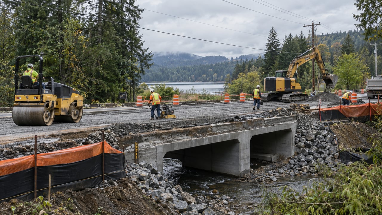
Buying in Maple Valley? What the SR 169 Fish Passage Project Near Black Diamond Means for You
The SR 169 fish passage project is a multi-year Washington State Department of Transportation project in Black Diamond, south of Maple Valley. For Maple Valley buyers, the practical question is not simply how close a home is to the construction. It is whether that home’s normal work, school, childcare, shopping, or recreation routes depend on the affected part of SR 169.
The current 2026 full closure near Jones Lake is temporary. More work and additional closures are planned for 2027, with final work expected in 2028.
WSDOT describes the project as the replacement of five fish-blocking culverts with larger fish-passable structures. The published project scope does not describe a general widening of SR 169 or promise a permanent commute improvement.
A buyer should separate short-term construction conditions from the property’s lasting fit. That means verifying the exact work-zone relationship, testing primary and backup routes, observing the property at useful times, and checking current WSDOT information instead of relying on an old listing description or a general statement about Maple Valley traffic.
Key Takeaways
- The active fish-passage project is in Black Diamond, not within the City of Maple Valley.
- The corridor may still matter to Maple Valley buyers whose routines take them south on SR 169 or through nearby detour routes.
- WSDOT scheduled the 2026 closure between Southeast 332nd Street and Plass Road for August 17 through September 21, subject to weather and site conditions.
- Additional closures are anticipated near Jones Lake and Black Diamond-Ravensdale Road in 2027.
- WSDOT says local access will be maintained, but through traffic must use signed detours during full closures.
- Construction noise, route effects, and access questions must be evaluated for the specific property.
- The project alone does not establish that a nearby home’s value will rise or fall.
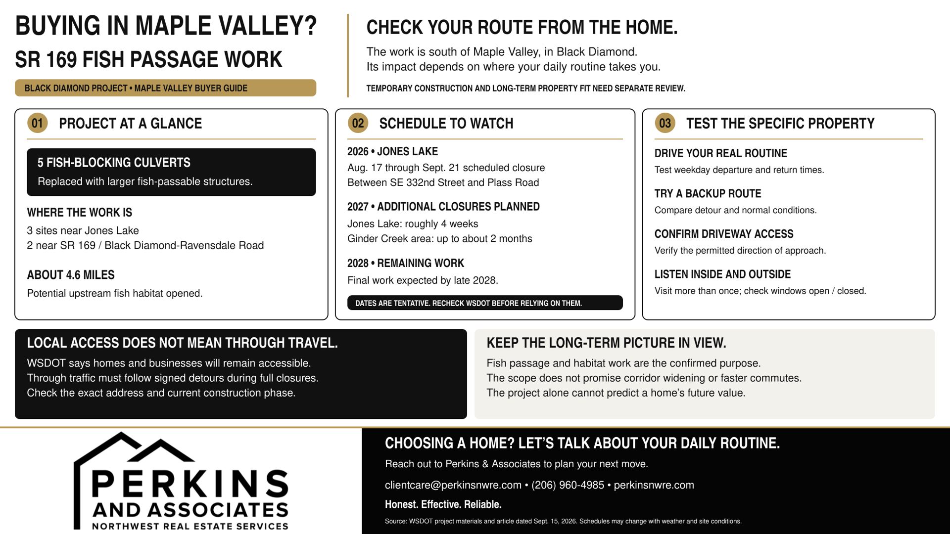
What Is the SR 169 Fish Passage Project, and Where Is It?
WSDOT is replacing five culverts that currently block fish passage beneath SR 169 and Black Diamond-Ravensdale Road. The sites are in Black Diamond. Three are near Jones Lake, and two are near the intersection of SR 169 and Black Diamond-Ravensdale Road.
The existing culverts carry Rock Creek, tributaries to Jones Lake, Ginder Creek, and a tributary to Ginder Creek. WSDOT plans to replace them with larger three-sided structures and restore more natural stream conditions.
The agency says the work could open approximately 4.6 miles of potential upstream habitat for native and migrating fish.
That location distinction matters. A Maple Valley address is not automatically near the work zone, and a buyer should not assume that every Maple Valley commute is affected. The exact route from the home to the buyer’s real destinations determines how relevant the project is.
What Is the Current Construction and Closure Schedule?
The schedule remains subject to weather, site conditions, design progress, and future WSDOT updates.
Phase | Current WSDOT Information | Buyer Relevance |
|---|---|---|
2026 | Full closure between Southeast 332nd Street and Plass Road began August 17. Reopening is scheduled for September 21. Construction may continue after reopening before pausing for winter. | Verify whether the home’s routine crosses the closure or detour network. Do not use the active detour as the only test of normal conditions. |
Jones Lake, 2027 | Another full closure is anticipated for roughly four weeks. WSDOT pages currently use estimates of approximately 25 and 28 days. The detailed timeline is not final. | Recheck the project page when comparing a 2027 move, commute, or closing schedule. |
Ginder Creek, 2027 | SR 169 near Black Diamond-Ravensdale Road may close for up to approximately two months. Full or partial closures are also possible on Black Diamond-Ravensdale Road. | This phase may affect a different set of routes and properties than the 2026 Jones Lake work. |
2028 | Remaining work, final paving, and striping are expected. Tentative completion is scheduled for October 2028. | Expect a multi-year project, but do not assume every phase involves a continuous full closure. |
Buyers should verify the schedule through the WSDOT SR 169 project page before relying on any date.
How Could the Work Affect a Maple Valley Buyer’s Daily Travel?
A closure can change commute reliability without affecting every buyer in the same way.
A buyer traveling north from a Maple Valley home may never cross the Black Diamond work zone. Another buyer who regularly travels south, visits Black Diamond, uses Green Valley Road, or depends on a route near Jones Lake may experience a much more noticeable change.
During the 2026 full closure, WSDOT established separate signed detours for passenger vehicles and freight traffic. That distinction matters because the detour network may change traffic patterns on more than one road. Navigation apps may also redirect drivers onto routes that feel different from the official detour.
Test the entire routine from the exact property. Drive it during the weekday departure and return times that matter to your household. Include school or childcare stops, errands, medical appointments, and weekend destinations.
Then test at least one backup route. A general city-to-city commute estimate cannot tell you whether a specific home works for your routine.
For a more complete testing framework, read our guide to testing your Maple Valley commute before choosing a home.
Will Homes and Businesses Remain Accessible?
WSDOT says homes and businesses along the affected section will remain accessible and that local access will be permitted during closures.
Local access, however, is not the same as unrestricted through travel. The direction of approach, construction stage, flagging, and signed closure limits may still change how someone reaches a driveway or business.
If a property is close to the project, ask a direct question:
From which direction can I reach this address during the current construction phase?
Confirm the answer through current WSDOT information and property-specific due diligence. Do not determine a nearby home’s access from a regional detour map alone.
How Should Buyers Evaluate Construction Noise Near a Specific Property?
There is no single project-wide answer for how much construction noise a particular home will experience.
Distance, terrain, trees, building orientation, windows, work stage, time of day, and existing highway noise can all affect what a buyer hears at the property.
WSDOT’s materials identify closures and some weeknight preparation work, but they do not provide a property-by-property noise forecast. A useful buyer review should include:
- Visit the home on more than one day and at more than one time.
- Listen from the primary bedroom, main living area, yard, and driveway.
- Check the sound with windows both open and closed.
- Separate ordinary SR 169 traffic noise from temporary construction activity.
- Ask which phase is active during the visit.
- Determine whether later work will move closer to or farther from the property.
- Review seller-provided information and ask appropriate professionals about any property-specific access notice, easement, or construction agreement.
A quiet showing during a construction pause does not prove that every construction period will be quiet. A noisy visit during active excavation also does not establish the property’s long-term sound conditions after the work ends.
Which Effects Are Temporary, and What Permanent Changes Are Confirmed?
Temporary or phase-specific effects may include:
- Full road closures
- Signed detours
- Flaggers and alternating traffic
- Construction vehicles
- Active-work noise
- Changing approaches to nearby properties and businesses
Confirmed long-term work includes:
- Five larger fish-passable structures
- Stream and habitat improvements
- Reconstructed roadway at the work sites
- Final paving and lane striping as needed
The published project materials do not establish:
- A general widening of SR 169
- Additional permanent travel lanes
- A guaranteed commute improvement
- A specific increase or decrease in nearby property values
This distinction protects buyers from making a permanent decision based only on a temporary inconvenience.
It also prevents the opposite mistake: assuming that every concern disappears when a closure ends. Existing road proximity, ordinary traffic, driveway configuration, and the household’s route needs will remain property-specific.
What Should Buyers Check Before Making an Offer?
1. Locate the property
Compare the address with WSDOT’s project-location and detour maps. Confirm whether it is north, south, or within the affected route network.
2. Map the household’s real routine
Include work, school, childcare, groceries, medical care, recreation, and regional highway connections.
3. Test normal and disrupted conditions
If possible, drive during the active closure and again after reopening. One test reveals disruption. The other provides a better picture of ordinary conditions.
4. Identify a backup route
Test an alternate route instead of assuming the navigation app’s second choice will be practical.
5. Verify property access
For a home near the work, confirm the permitted direction of approach during each relevant phase.
6. Observe the property at different times
Visit during useful weekday and weekend periods. Check indoor and outdoor sound, nearby traffic movements, and driveway use.
7. Review property-specific information
Use seller-provided materials and qualified professionals to investigate any notice, easement, access arrangement, or other issue tied to the parcel.
8. Check for project updates
Revisit WSDOT before making an offer, before removing relevant contingencies, and shortly before closing if construction could affect the move.
Expert Insight: Test the Permanent Fit, Not Only the Temporary Detour
Temporary construction and permanent property fit are two different decisions.
The current detour can show how resilient a household’s routine is when the main route is disrupted. It should not be treated as the only picture of everyday life near the home.
After reviewing the project, return to the questions that will still matter when construction ends:
- How close is the home to ordinary traffic?
- Can you reach your daily destinations without depending on one route?
- Is the driveway comfortable to use?
- Does the home’s indoor and outdoor sound level work for you?
- Are you comfortable repeating the routine several days each week?
Good local guidance does not turn roadwork into a promise or a warning about every nearby property. It helps a buyer identify what is confirmed, what is temporary, what remains uncertain, and what must be tested at the actual home.
Frequently Asked Questions
Is the SR 169 fish passage project in Maple Valley?
No. WSDOT identifies the five project sites as being in Black Diamond. The project is relevant to Maple Valley buyers because SR 169 connects the communities and may be part of their daily travel.
When is the current SR 169 closure scheduled to end?
WSDOT scheduled the 2026 full closure between Southeast 332nd Street and Plass Road to end September 21, 2026. The reopening remains subject to weather and site conditions.
Will SR 169 close again in 2027?
Yes. WSDOT anticipates another closure near Jones Lake for roughly four weeks and a separate closure near Black Diamond-Ravensdale Road for up to approximately two months. Detailed timing may change.
Will residents still be able to reach their homes?
WSDOT says local access will be permitted and homes and businesses will remain accessible. Buyers near the work zone should still verify the allowed direction of approach for the specific address and construction phase.
Is this project widening SR 169?
The published project scope describes culvert replacement, fish-passable structures, habitat work, roadway reconstruction at the work sites, and final paving or striping. It does not describe a general corridor-widening project.
Will the project raise or lower nearby home values?
The project alone does not provide enough evidence to predict a specific home’s value. Pricing depends on property condition, location, comparable sales, inventory, buyer demand, ordinary road exposure, and many other factors.
Where can buyers find current information?
Use WSDOT’s project page, online project hub, real-time travel map, and email updates. Recheck close to any decision that depends on access or timing.
Helpful Resources
- WSDOT SR 169 project page
- WSDOT Engage project hub
- WSDOT real-time travel map
- Moving to Maple Valley? Test Your Commute Before Choosing a Home
- Thinking About Moving to Maple Valley? What Buyers Should Know First
Planning Your Next Move
If you are thinking about buying, selling, or planning your next move, our team is happy to help you think through your options and next steps.
Email: [email protected]
Phone: (206) 960-4985
Honest. Effective. Reliable.


