Short Answer: Maple Valley is working on safer walking, biking, and non-motorized connections through its Active Transportation Plan and the planned SR 169 pedestrian bridge near SE 258th Street. These projects may improve access between neighborhoods, Rock Creek Elementary, the Legacy Site, the future downtown area, the Cedar to Green River Trail, Lake Wilderness, and other city amenities. For buyers, walkability should be evaluated as part of daily life, commute patterns, school access, and long-term neighborhood fit.
Maple Valley has long been known for its parks, trails, suburban setting, and community feel. But like many growing South King County communities, the city is also facing a practical question: how can residents move more safely between neighborhoods, schools, trails, parks, transit stops, and future downtown amenities?
That is where Maple Valley’s walkability push matters.
In 2026, the city is moving forward with an Active Transportation Plan and continuing work on the SR 169 pedestrian bridge near SE 258th Street. For buyers, this is not just a transportation topic. Safer crossings, better sidewalks, bike connections, school access, and trail connectivity can all influence how a neighborhood feels day to day.
This guide explains what buyers and homeowners should know before making real estate decisions around Maple Valley’s next phase of walkability planning.
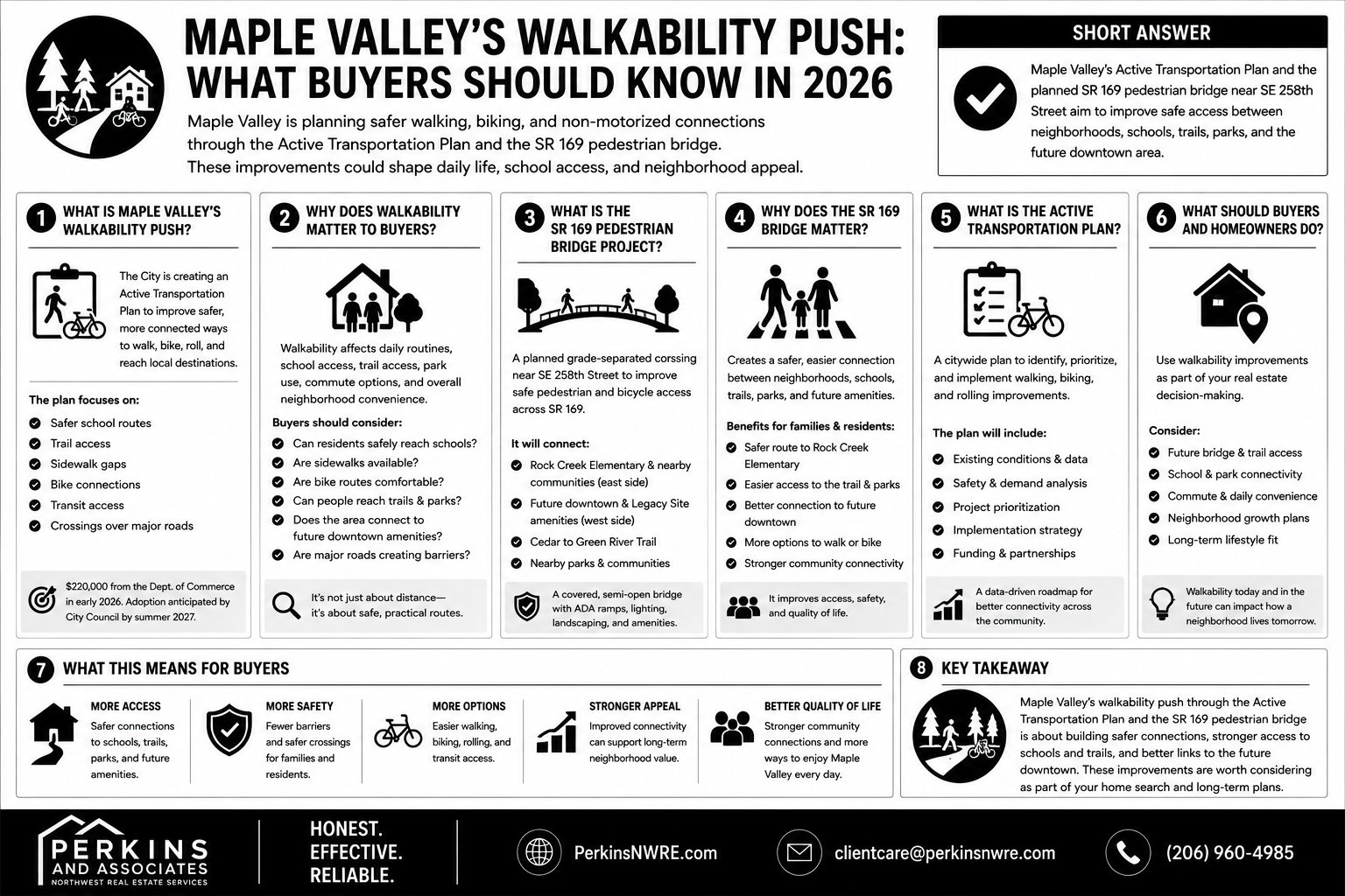
What Is Maple Valley’s Walkability Push?
Maple Valley’s walkability push refers to the city’s efforts to improve safer, more connected ways for people to walk, bike, roll, and access local destinations without relying only on cars.
The City of Maple Valley’s Active Transportation Plan page says the city received $220,000 from the Department of Commerce in early 2026 to complete the plan. The city expects the plan to establish a data-driven, safety-focused, implementation-ready framework, with adoption anticipated by City Council by summer 2027.
Active transportation generally includes walking, biking, rolling, and other non-motorized travel. In a city like Maple Valley, that can include safer school routes, trail access, sidewalk gaps, bike connections, transit access, and crossings over major roads.
For buyers, this matters because walkability is not only about being close to a destination. It is about whether the route feels safe, practical, and usable.
Why Does Walkability Matter to Maple Valley Buyers?
Walkability matters to Maple Valley buyers because it can affect daily routines, school access, trail access, park use, commute options, and overall neighborhood convenience.
A home may look close to a school, park, trail, or community space on a map. But if the route requires crossing a busy highway, walking on a shoulder, or taking a long detour, the real-life experience may be very different.
Buyers should think about walkability in practical terms:
- Can residents safely reach nearby schools?
- Are sidewalks available where they are needed?
- Are bike routes comfortable and connected?
- Can people reach trails, parks, and transit without difficult crossings?
- Does the neighborhood connect to future downtown amenities?
- Are major roads creating barriers between neighborhoods and services?
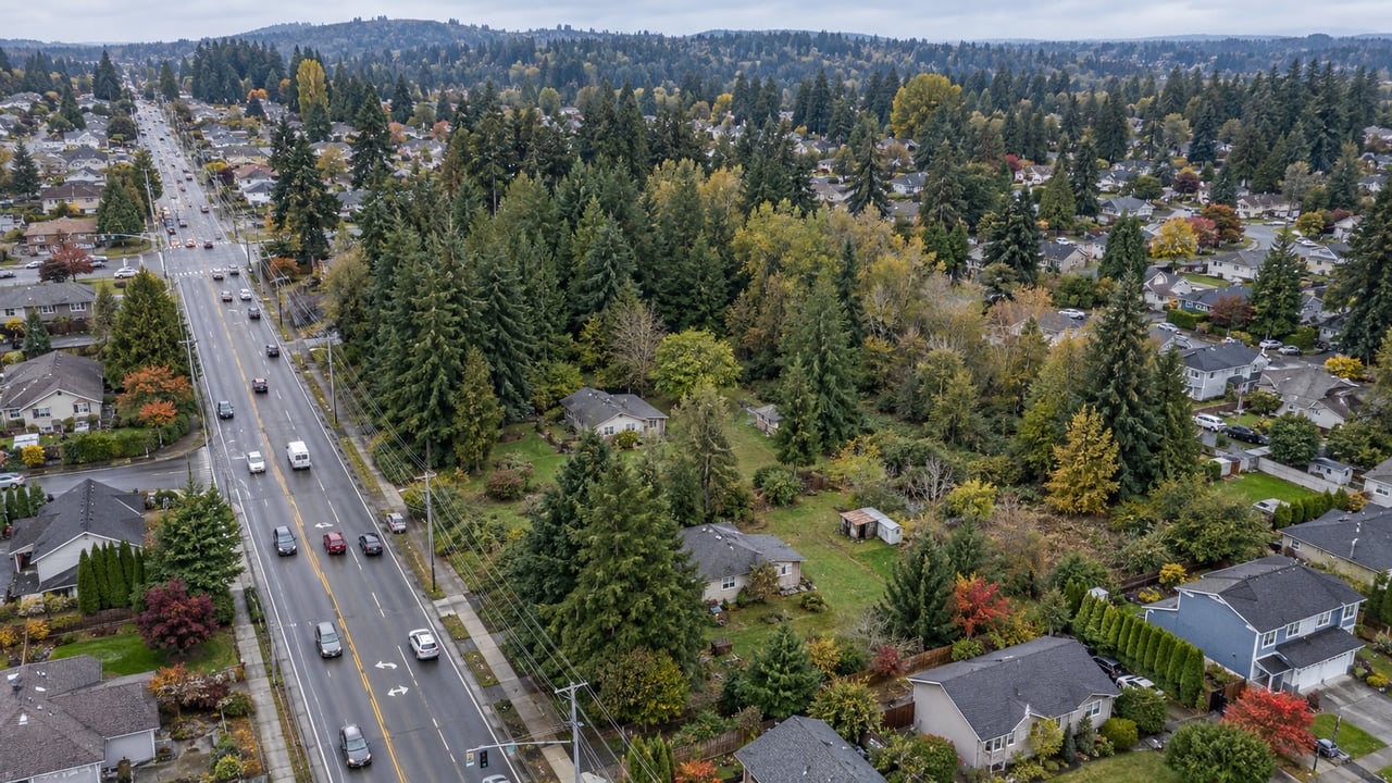
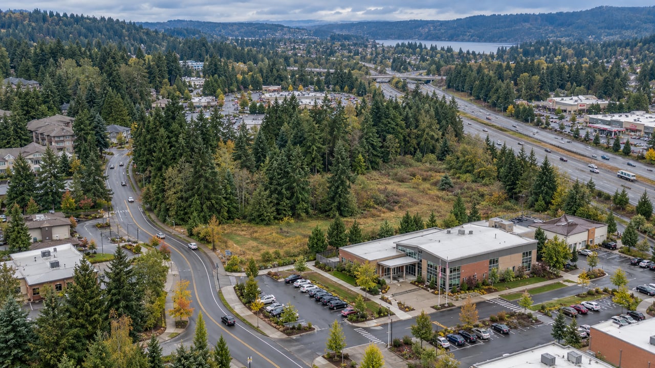
In Maple Valley, SR 169 is one of the biggest examples of this issue. It functions as a major transportation corridor, but it can also separate neighborhoods from community destinations.
What Is the SR 169 Pedestrian Bridge Project?
The SR 169 pedestrian bridge project is a planned grade-separated crossing near SE 258th Street designed to improve safe pedestrian and bicycle access across SR 169.
The City of Maple Valley’s SR 169 Pedestrian Bridge project page explains that the bridge would connect the east side of SR 169, including Rock Creek Elementary and nearby communities, with the west side of SR 169, including the city’s future downtown, Legacy Site public amenities, the King County Regional Cedar to Green River Trail, nearby communities, and other city parks.
The project area is significant because SR 169 is a busy state highway and currently lacks safe crossing points for pedestrians near the proposed bridge location. The city has identified pedestrian safety, school access, market access, trail access, and downtown connectivity as major reasons for the project.
A 2026 public notice for the project also described the proposal as a covered, semi-open, grade-separated pedestrian bridge over SR 169 with ADA ramps on both sides, lighting, landscaping, and related public amenities.
Why Does the SR 169 Bridge Matter for Families and Daily Life?
The SR 169 pedestrian bridge matters because it is designed to create a safer connection between residential neighborhoods, school access, trails, parks, and future downtown amenities.
For many buyers, especially those comparing Maple Valley neighborhoods, the question is not only whether a home is near amenities. The better question is whether those amenities are realistically accessible.
The bridge is expected to support access to:
- Rock Creek Elementary
- Nearby residential neighborhoods east of SR 169
- The Legacy Site
- The Maple Valley Farmers’ Market area
- The future downtown area
- The Cedar to Green River Trail
- Lake Wilderness
- City parks and public amenities
- Metro transit access along the SR 169 corridor
This does not mean every home near the project automatically becomes more valuable. But it does mean buyers may increasingly ask how a property connects to daily destinations, safe routes, and local amenities.
How Does the Active Transportation Plan Fit Into This?
The Active Transportation Plan is the broader citywide framework, while the SR 169 pedestrian bridge is a specific project that reflects Maple Valley’s larger walkability and safety goals.
The Active Transportation Plan is intended to look at the city’s overall walking, biking, and non-motorized transportation network. That can help Maple Valley identify gaps, prioritize projects, and plan for safer connections over time.
The SR 169 pedestrian bridge is more targeted. It focuses on one major barrier: crossing SR 169 near SE 258th Street.
Together, these efforts show that Maple Valley is not only thinking about roads for cars. The city is also planning for how residents access schools, trails, transit, parks, downtown activity, and public spaces.
For buyers, this provides useful context. A home’s location may become more meaningful when viewed through future connectivity plans, not just today’s driving routes.
What Should Buyers Watch Before Buying Near Walkability Projects?
Buyers should watch project timelines, construction impacts, access changes, nearby land uses, and whether planned improvements actually serve their daily needs.
Walkability projects can be appealing, but buyers should avoid making assumptions. A project may be under design, under review, funded in stages, or dependent on construction schedules. Timelines can change.
Before buying near an active or planned project, buyers should ask:
- Is the project funded, designed, approved, or still in planning?
- When is construction expected?
- Could construction temporarily affect traffic or access?
- Does the project improve a route the household would actually use?
- Are sidewalks, trails, and crossings already connected nearby?
- Are there schools, parks, transit stops, or commercial areas within a practical route?
- Could nearby traffic patterns change?
- Are there other transportation projects planned in the area?
A project like the SR 169 pedestrian bridge may improve connectivity, but buyers should still evaluate the specific home, street, route, and daily routine.
What Does This Mean for Sellers and Homeowners?
For sellers and homeowners, walkability planning may shape buyer questions about safety, access, convenience, and neighborhood context.
A seller near a trail, park, school, or future connection should be prepared to discuss location clearly and accurately. That does not mean promising future value or overstating benefits. It means helping buyers understand what is nearby, what is currently accessible, and what official city planning documents say.
Homeowners should also watch city updates because walkability projects can affect:
- Construction timing
- Traffic patterns
- Pedestrian access
- Nearby public spaces
- Buyer questions during resale
- How residents use local amenities
This should be treated as useful context, not a pricing guarantee. Pricing should still be based on current comparable sales, property condition, market activity, and buyer demand.
What This Means for Maple Valley’s Long-Term Growth
Maple Valley’s walkability efforts are part of a larger conversation about how the city grows while keeping daily life connected and accessible.
As Maple Valley plans around the Legacy Site, future downtown, trails, parks, and major transportation corridors, safe connections become increasingly important. A city can have strong amenities, but those amenities are more useful when residents can reach them safely and comfortably.
For buyers, this makes walkability a real estate consideration. It may not replace price, home condition, or commute needs, but it can help explain why one location may feel more practical than another.
For homeowners, it reinforces the importance of paying attention to city planning. Transportation improvements can shape how neighborhoods function over time, even when they do not directly change a property.
Expert Insight: Why Walkability Should Be Part of Buyer Due Diligence
Walkability should be part of buyer due diligence because daily convenience is not always obvious from a listing description.
A home can be close to a school, park, trail, or downtown area but still feel disconnected if crossings are difficult, sidewalks are missing, or routes are not practical. On the other hand, a home with strong access to trails, sidewalks, and safe crossings may support a smoother daily routine.
For Maple Valley buyers, the strongest approach is to test the route before making assumptions. Drive it. Walk it if safe. Review city project maps. Check school, park, trail, and transit access. Ask whether planned improvements are already built, funded, under design, or still conceptual.
The right Maple Valley home is not only about the house. It is also about how the location works day to day.
FAQ
What is Maple Valley’s Active Transportation Plan?
Maple Valley’s Active Transportation Plan is a citywide planning effort focused on safer walking, biking, rolling, and non-motorized travel. The city received funding in early 2026 to complete the plan and anticipates adoption by summer 2027.
What is the SR 169 pedestrian bridge in Maple Valley?
The SR 169 pedestrian bridge is a planned pedestrian and bicycle crossing near SE 258th Street. It is intended to connect neighborhoods east of SR 169 with Rock Creek Elementary, the Legacy Site, the future downtown area, trails, parks, and other public amenities.
Why does the SR 169 bridge matter for homebuyers?
The bridge matters because it may improve safe access across a busy highway corridor. Buyers may care about this if they are evaluating school access, trail access, transit connections, parks, and daily convenience.
Does walkability increase home values in Maple Valley?
Walkability can influence buyer interest, but it does not guarantee higher home values. Pricing should still be based on comparable sales, property condition, market demand, and the specific features of the home.
Should buyers purchase near a planned transportation project?
Buyers should evaluate planned transportation projects carefully. They should verify project status, construction timing, expected access changes, and whether the improvement actually supports their daily needs before making assumptions.
What should sellers say about nearby walkability improvements?
Sellers should share accurate, source-backed information about nearby amenities and official city projects, but should avoid making promises about future value. Walkability improvements should be treated as neighborhood context.
Helpful Resources
- City of Maple Valley Active Transportation Plan
Official city page explaining Maple Valley’s active transportation planning effort, funding, and expected timeline. - City of Maple Valley SR 169 Pedestrian Bridge Project
Official project page for the planned pedestrian bridge near SE 258th Street. - Maple Valley SR 169 Pedestrian Bridge SEPA Notice
Public notice describing the proposed bridge, ADA ramps, lighting, landscaping, and project location. - PSRC SR 169 Pedestrian Bridge Grant Application
Helpful project context on how the bridge connects residential communities, Rock Creek Elementary, the Legacy Site, and downtown commercial areas. - City of Maple Valley Current Transportation Improvement Projects
Useful for reviewing active transportation and roadway projects across the city.
Why Buyers and Sellers Across Maple Valley Trust Perkins & Associates
Whether you are comparing Maple Valley neighborhoods, watching local infrastructure projects, or preparing to buy or sell, having the right local guidance can make the decision clearer. Perkins & Associates helps clients understand Maple Valley real estate with honest advice, local insight, and a strategy tailored to their goals.
If you are thinking about buying, selling, or planning your next move, Perkins & Associates is happy to help you think through your options and next steps.
📧 [email protected]
📱 (206) 960-4985
Honest. Effective. Reliable.